
Trekking in Gambier

Who would have thought that trekking in Gambier could be as much fun as it was? We were certainly surprised at the different options we had. Gambier is a great mix of the Marquesas with its soaring peaks and Tuamotos with its sandy atolls. We did a bit of diving, but what really captured us was the amazing trekking in Gambier.

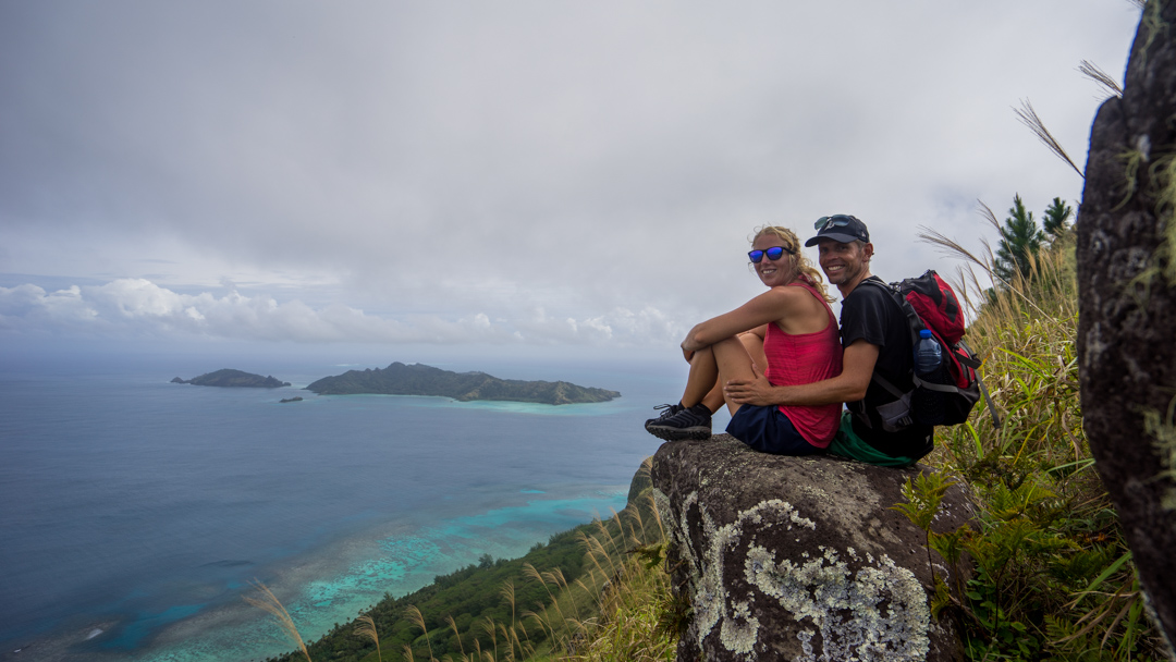
When we sailed in to Gambier, we saw several islands that rose majestically out of the sea and being Norwegians fond of mountains, we immediately thought: let’s get to the top of them. On Mangareva (the main island in Gambier) there are two peaks: Mount Duff and Mount Mokoto. Mangareva means floating mountain in Polynesian and was named so, because Mount Duff rises 482 meters out of the crystal clear seas. On our second day on the island, Margrethe and I put on our trekking shoes and set off to climb Mount Duff.


Mount Duff gets its name from the ship Duff, which James Wilson captained to Gambier in 1797. He named the group of islands after Admiral James Gambier, a British hero of the Napoleonic wars. The admiral had helped fund the expedition that brought Captain Wilson to the islands, so naming the group after the admiral seemed like a fitting thank you.

You would think that climbing 482 meters would be no problem. After 2 weeks at sea, basically either sitting or laying down, we were somewhat out of shape. In addition, the trail to the top is very steep and is made quite treacherous by being completely covered with pine needles. We were drenched with sweat and had trembling muscles when we got to the top and could enjoy the breathtaking view.

A week later we also went to the top of Mount Mokoto, which is only a bit shorter, but the trek to the top was much more comfortable, probably because we were in better shape and because the trail follows the ridge and doesn’t go straight up. We hiked to the top of Mokoto together with the crew from Aldebaran and enjoyed not only a great hike, but also sensational company.


When we first arrived in Gambier, we anchored in a bay (Baie Gahutu) on the island Taravai. There was a nice looking ridge, with a couple of tops that would give a good view of the bays around the islands, but there was no way to get through the dense jungle and vegetation by the beaches. You’d need a crew armed with chainsaws and machetes to pull it off and since we’re into non-intrusive hiking, we were left to stare up at the tops. Towards the end of our stay we were anchored off the village on the other side of Taravai and there we found a path and hiked to one of the tops together with Hannes and Lydia from the boat Blue Lilly. Though the top wasn’t very high, is was a strenuous hike, forcing us to walk halfway around the island, before we could get to a ridge leading upwards. The vegetation on the island was extremely dense, so it was impossible to get anywhere unless on a path.


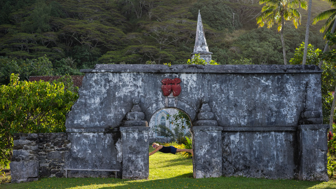
Not all our hiking went upwards, we also walked around a couple of the islands. There is a nice 5 hour walk along the Mangarevan coastline, taking you along the semi-paved road that leads around the northern tip of the island. All the treks take you past the main church in town, which has a “dark” history. The building of the church and several other buildings and arches were supervised by a missionary priest named Father Honore Laval. He converted the locals to Christianity with a bloody hand, forcing the locals to build the various buildings and succeeded in decimating the population from 9000 to 500.

On Mangareva there are two traverse trails that were used in the old days before the road that hugs the shoreline was built. They take you between the east and west side of the island right over the ridge. They were also steep and proved to be quite a work-out. What many of the trails and hikes have in common is that they take you past a treasure throve of wild growing fruit and vegetables. Every time we went hiking we always brought an extra backpack, just so that we could harvest anything that looked good along the trail. We were able to gather a large selection, not limited to papayas, avocados, eggplant, lemons, pamplemousse, chilies and many large pumpkins. Elsewhere this would have cost us a fortune, but here it was free and the locals applauded our efforts and in many cases came and gave us things from their gardens, because everything grows in an abundance.


We spent a couple of days on the east side of the atoll circling the islands and decided to walk the length of the one airfield in the Gambiers. We had a lot of fun pretending to be airplanes and were goofing off on the runway taking pictures. After a bit we walked over to the terminal building when to our surprise there were a few people standing there. They were even more surprised to see us and when they heard that there were two people still on the runway, the firetruck roared to life and sped off with the siren blaring. Not even a minute later, a Learjet (private airplane) landed … So that could have been a mess. The locals didn’t get upset and we even got to peak onboard the Learjet, to see how the rich and famous travel. Not surprisingly they travel in comfort. We were hoping that the passengers would be someone famous, but they looked to be Russian business people. They were picked up by a mega yacht named Plan B, that took them on a 3-4 day trip to Pitcairn.


It’s safe to say that our treks have been exhilarating in more ways than one. We’ve greatly enjoyed the trekking in Gambier, because it gave us the possibility to move around and stay in shape, something that can be a challenge when you live on a sailboat and spend much time on the ocean.